

Wholesale U.S. Virgin Islands – Large Print Navigation Chart 132E
WSP
Sign up for Faire to unlock wholesale pricing
MSRP $34.95
Already have a retailer account? Sign in
SKU 132E - R
With Faire, shop unique wholesale products for your store from brands like Waterproof Charts and more.
About this product
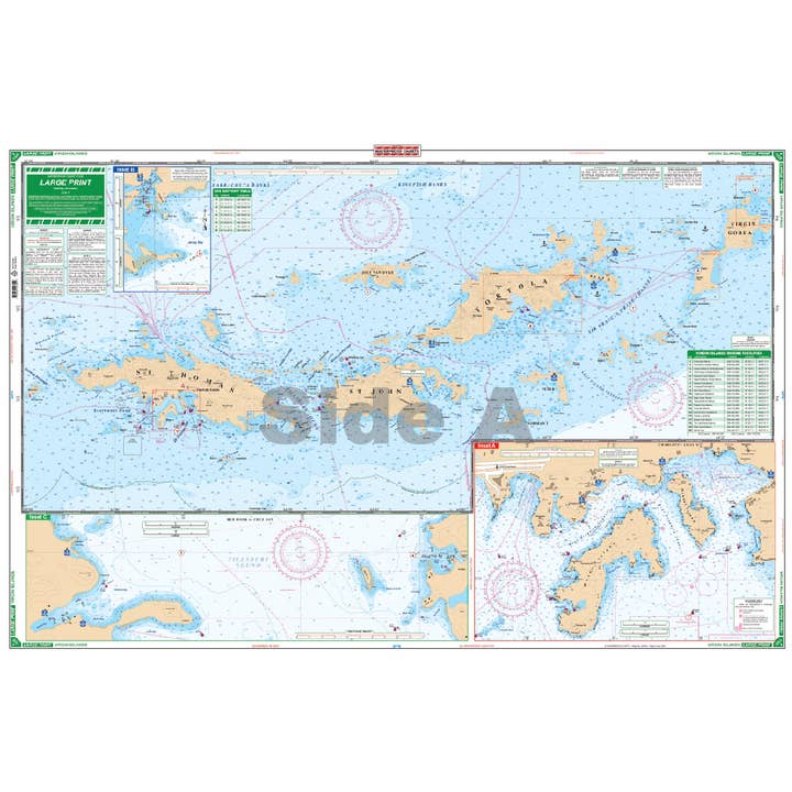
Chart #132E – US & British Virgin Islands Nautical Chart Ideal for bareboat chartering, this two-sided nautical chart offers detailed coverage of the US and British Virgin Islands, excluding St. Croix. It features GPS waypoints, marina listings with contact information, and customs office locations. Side A covers St. Thomas to Virgin Gorda with detailed insets for key harbors, while Side B extends from East Tortola to Anegada, including major ports and cruising spots. All depth soundings are in feet, and approach channel details for Anegada are included. Based on five government marine charts and private sources, this 25” x 38” chart is an essential navigation tool. WGS84 - World Mercator Datum.
Product details
• Made in United States • Weight: 113.4 g (4 oz) • Dimensions: 96.5 x 63.5 x 0.3 cm (38 x 25 x 0.1 in) • SKU: 132E - R
©2025 Faire Wholesale, Inc.